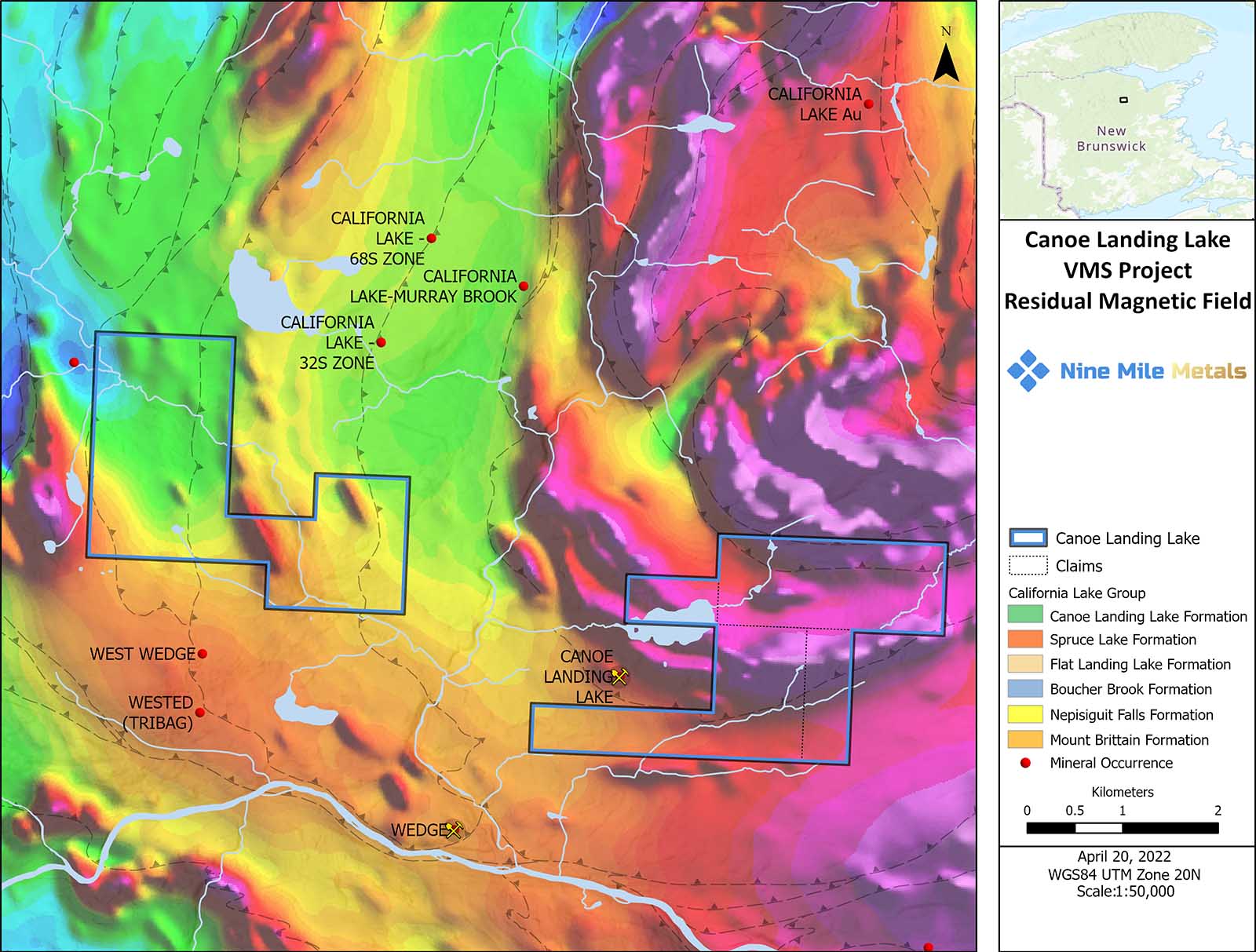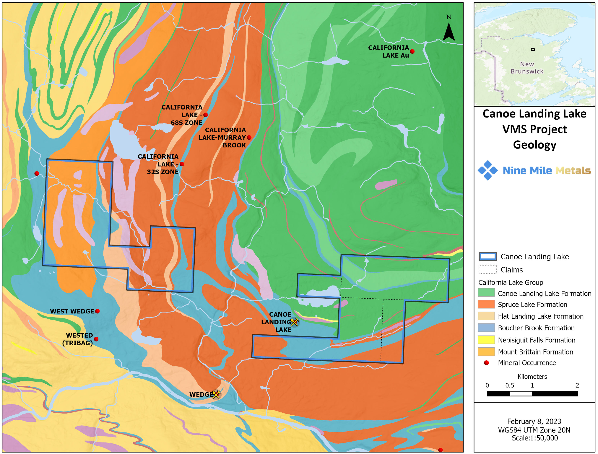
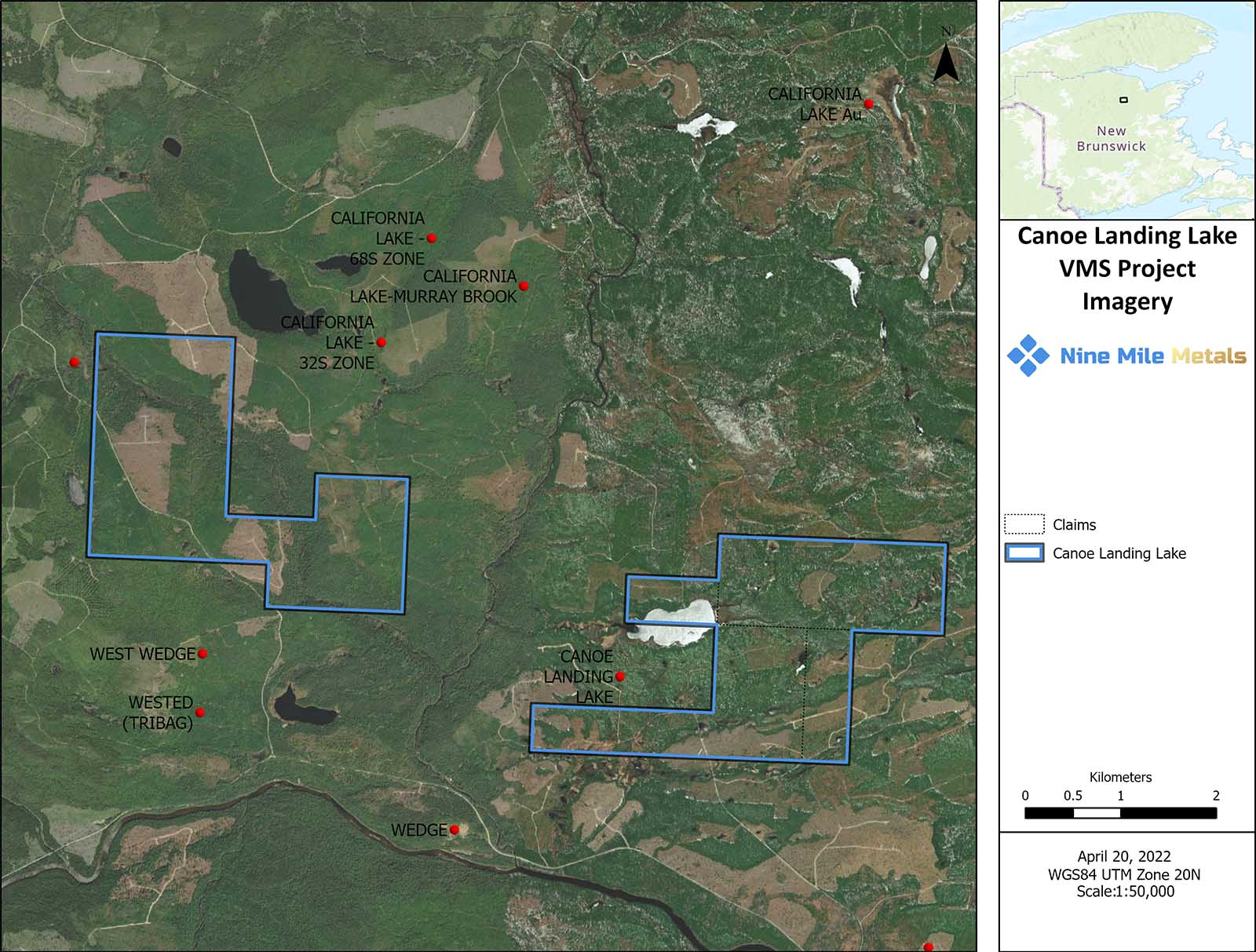
The Canoe Landing Lake West property is 10.82 Km2 in size and 10 kilometers west of Nine Mile Brook. The property is central to 9 occurrences / deposits including 3 kilometers northwest the Canoe Landing Lake Deposit (22.8 million tons) with geological reserves of 0.64% Pb, 1.82% Zn, 0.56% Cu. 0.94 oz/ton Ag and 0.034 oz/ton Au and the historic Wedge Mine which produced 1.5 million tonnes grading 2.88% Cu, 0.88 % Pb, 1.75% Zn and unspecified Ag credits.
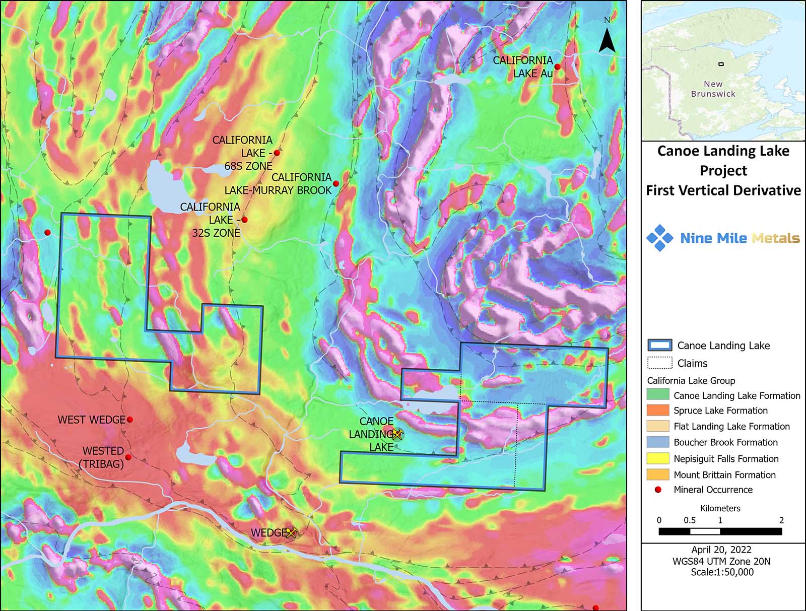
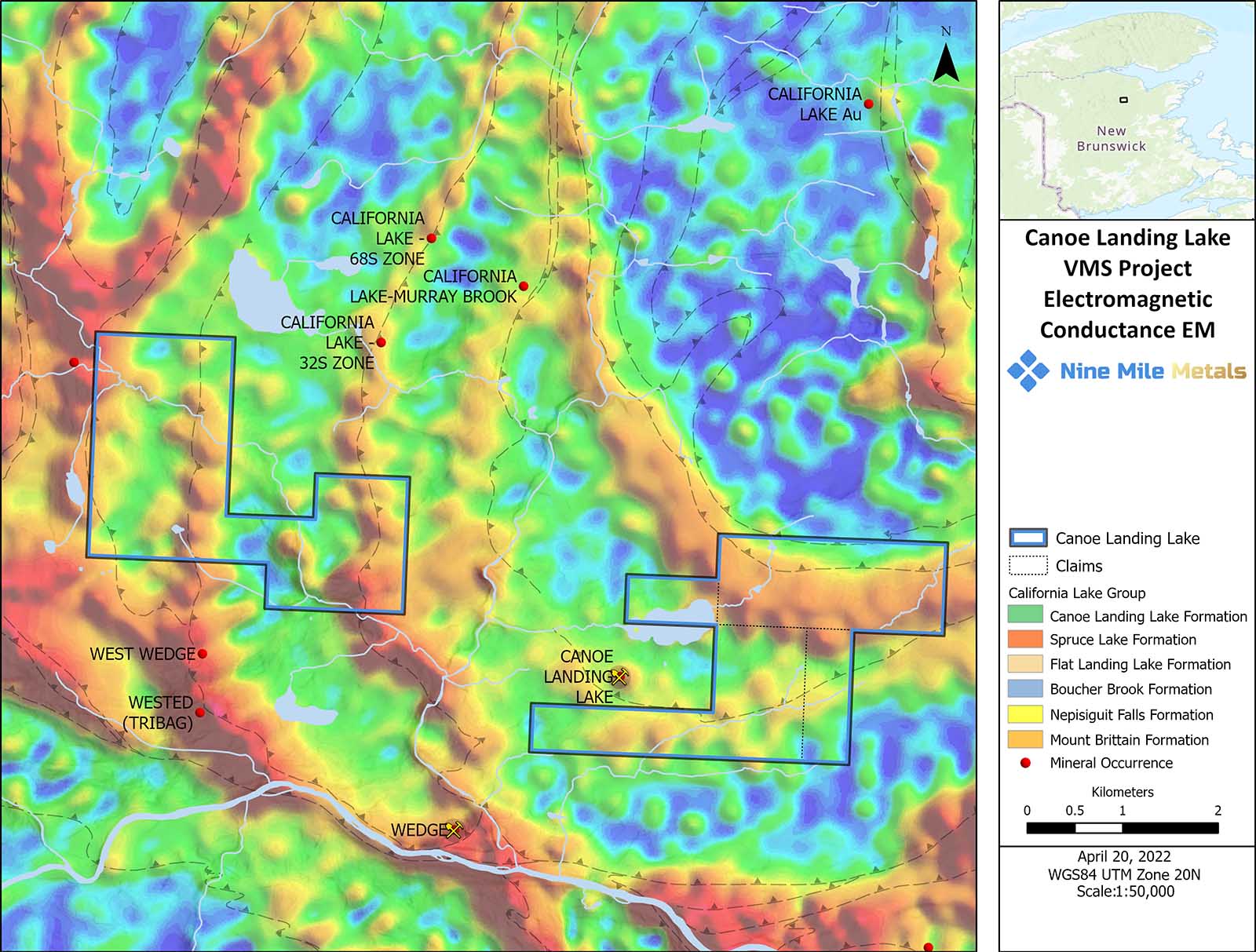
The underlying geology is the California Lake Group, including the Spruce Lake rhyolite present at Nine Mile Brook and in the deep footwall of the Canoe Landing Lake deposit and the Boucher Brook sediments that host the deposit.
Exploration at Canoe Landing Lake West will focus on locating targets along the north trending sediments, volcanics and their contacts, the latter key to mineralization at the Wedge, California Lake, California Lake 68S, Wested (Tribag) and Lower Forty Mile Brook. This will be accomplished by utilizing Cutting Edge 3D – AI Technologies and advanced modelling. Targets will be defined and followed up on the ground with detailed prospecting and soil geochemistry.